Stormwater Runoff Takes Bite Out of R.I.’s Vulnerable Coastline
June 14, 2021
Share
The video below is just one example among countless others statewide of stormwater runoff gushing after a rainstorm. This scene at innumerable locations plays out every time it rains in Rhode Island, which, in this age of global heating, is happening with more intensity more frequently.
Besides rushing a smorgasbord of land-based pollutants into Rhode Island’s marine waters, including Narragansett Bay, the state’s economic crown jewel, stormwater runoff also exacerbates coastal erosion.
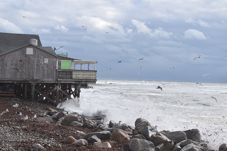
Stormwater runoff, like tidal action and storm surge, erodes waterways and increases coastal flooding. It is, among many other things, stressing the Ocean State’s prized natural resource.
Narragansett Bay’s 700 billion gallons of water cover 150 square miles, and its 1,700-square-mile watershed nurtures thousands of species of flora and fauna. This watershed, which is shared by Rhode Island and Massachusetts, also supports more than 2 million residents and attracts roughly 12 million tourists annually. Some 300,000 professionals and amateurs fish its waters every year, and more than 30,000 recreational boaters annually explore the bay and its many tributaries.
Estimates have suggested that the total value of the natural resources of the Narragansett Bay watershed — 60 percent of which resides in Massachusetts while 90 percent of its waters are in Rhode Island — exceeds several billion dollars annually. The bay’s health is important, but it’s threatened by the acres upon acres of impervious surface that covers much of its watershed.
In Rhode Island, about 14 percent of the Narragansett Bay watershed is under streets, roofs, driveways and parking lots. These surfaces hurry stormwater containing bacteria (from animal and human waste), nutrients (from fertilizers), pesticides (from lawn and garden chemicals), petroleum byproducts and other fluids (from motor vehicles) and other contaminants into the bay when it rains.
The number of extreme precipitation events occurring annually in Rhode Island has doubled since 1914, according to the Green Infrastructure Coalition. Since 1905, the amount of annual precipitation in Rhode Island has increased by 12 inches, mostly during non-summer months, according to the University of Rhode Island/Rhode Island Sea Grant Climate Change Collaborative.
The result of this accumulating non-point pollution is toxic algae blooms, contaminated recreational waters, stressed infrastructure, closed beaches and shellfishing areas and lost money.
Within Rhode Island, impervious cover by municipality in the Narragansett Bay watershed ranges from 3 percent to 40 percent. When asphalt, cement and shingles cover between 10 percent and 25 percent, nearby streams show clear signs of degradation. When such cover is less than 10 percent, streams support a wide range of life. More than 25 percent impervious cover leads to impaired waters such as the Seekonk and Providence rivers.
Relentless development within the Narragansett Bay watershed has increased the amount of runoff and its impact on water quality, public health, marine life, coastal habitats and coastal erosion. Increasing rates of development, combined with increases in the occurrence of intense storms, will generate even more runoff in the future and at faster rates.
To address the problems associated with stormwater runoff, more rain needs to be absorbed into the ground. That means installing green infrastructure — rain gardens, rain barrels, and bioswales — and ripping up pavement.
Teresa Crean, a community planner and coastal management specialist with the Coastal Resources Center at URI, noted small-scale interventions, like planting trees and vegetative buffers and mowing grassy areas less, move the needle when it comes to better managing stormwater runoff.
While major enterprises, most notably the Narragansett Bay Commission’s three-phase combined sewer overflow project, have greatly reduced the amount of stormwater being discharged into Narragansett Bay, Crean said smaller, less expensive projects can accomplish plenty, including helping to engage stakeholders in an important but often overlooked issue. Smaller projects also empower communities to adapt.
“Those kind of projects add up and they get neighborhoods involved,” said Crean, who has been working with state and local officials and the public for the past dozen years on stormwater management and other coastal issues. “Taking up asphalt roads to nowhere and building rain gardens makes a difference.”
And Rhode Island, she noted, has a lot of asphalt and concrete sections that serve no purpose other than to help move stormwater along. These roads to nowhere and random patches of impervious surface are slowly being ripped up.
Antiquated infrastructure
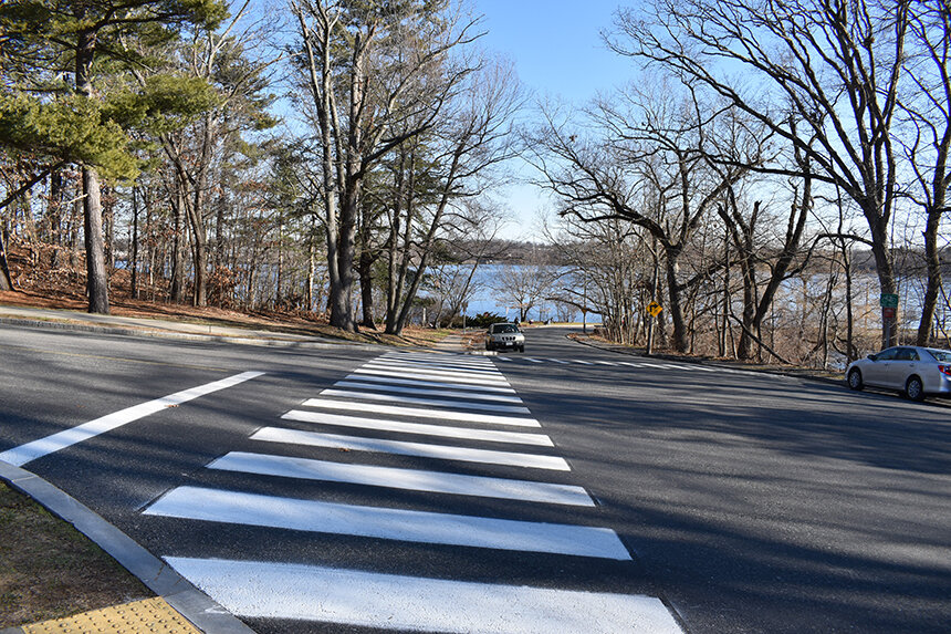
Late last year the Green Infrastructure Coalition produced a video that highlighted some of the problems being caused by stormwater runoff along River Road in Providence. The road, which runs next to the Seekonk River, a tidal estuary that empties into Narragansett Bay, is part of a mini-watershed that includes York Pond, Blackstone Boulevard, Irving Avenue, Gulf Avenue and Loring Avenue. Much of the stormwater runoff from this area drains into Baileys Lower Cove.
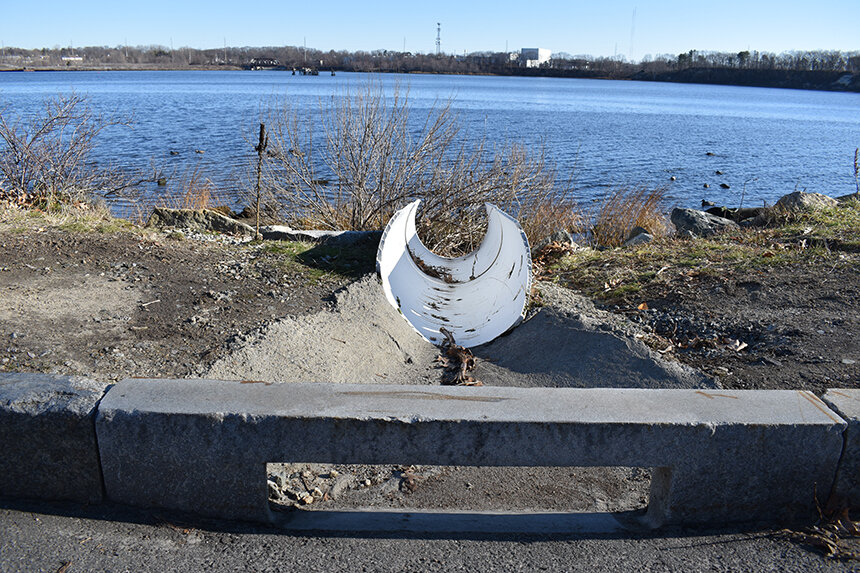
Municipalities, including Providence, largely manage stormwater with outdated infrastructure practices — gutters, basins and pipe that quickly carry runoff to the nearest waterbody, be it a stream, river, lake, cove or bay. As the Green Infrastructure Coalition notes, most municipalities lack the staff and funding to maintain their aging stormwater infrastructure.
The most visual result of this lack of municipal attention is that unmaintained storm drains fill with sediment, which causes rain to back up, flooding streets, homes and businesses. But there are more-subtle implications.
The Green Infrastructure Coalition’s 12-minute video features Wenley Ferguson, director of habitat restoration for Save The Bay, talking about some of the projects implemented and planned for this East Side mini-watershed to lessen the impacts of stormwater runoff.
She noted riprap was placed in one significant area along River Road to help alleviate the erosion of the Seekonk River’s banks.
“We have a lot of stormwater coming down from Irving Avenue, where it joins with River Road, and that runoff comes down with such velocity that it literally has caved this bank away,” Ferguson said. “There is a granite block wall all along the Seekonk River here and the velocity of that stormwater runoff over years and years of no management of the stormwater literally has caused this entire bank to collapse.”
Before the city added that riprap a few years ago, this area where stormwater was pouring into the Seekonk River was a “complete gully,” she said. The city is also working on repairing the granite wall that years of unmanaged stormwater has crippled.
While adding riprap, fixing the wall and planting native grasses along the shoreline are needed steps in reducing erosion, Ferguson said “an important component is to address the volume of water that comes down and discharges at this point.”
The plan, she said, is to reduce that volume by installing stormwater infiltration areas, such as bioswales, further up the River Road watershed.
Ferguson noted there also have been discussions about depaving parts of the wide, steep intersection where Irving Avenue, coming down from Blackstone Boulevard, meets up with Loring Avenue.
Ripping up pavement, like proposed for this area, creates three benefits when it comes to managing stormwater: slows the speed of runoff; allows for filtration into the ground; and creates more space to install bioswales and rain gardens.
“What we’re proposing talking to the city … is reducing the width of this roadway, cutting it back, and narrowing it so it will have the benefit of calming or slowing the traffic down … and using the space where the pavement has been removed for stormwater infiltration. There’s a lot of real estate here to manage the stormwater before it gets to that discharge that you saw where the erosion was occurring and there was literally no space to do any stormwater management.”
Erosion seems to potentially be a problem for water quality in the bay as well, not just an issue of disappearing land. The value of green infrastructure as a scalable solution for water quality issues in the bay appears to be limited. This recent research investigates these questions https://dx.doi.org/10.3368/wple.96.4.457