Warmer and Wetter Cause Big Problems for Little Rhody
Changing climate is soaking Rhode Island with more rain and warming it with higher temperatures
May 15, 2020
Did you notice that it snowed so little last winter that you barely shoveled, plus it never turned brutally cold? Or that the daffodils bloomed a few weeks earlier this spring? And that there were scores of jellyfish in April, while we typically don’t have to avoid them until summer?
While you might have relished the lack of shoveling and the premature blooms, these regional weather events weren’t random occurrences. They are ongoing evidence. Weather experts across the globe have been citing warmer weather and its consequences for decades, so the four straight warmer-than-normal months — December through March — in the Northeast shouldn’t come as a surprise.
Since 1998, the country has experienced the 10 warmest years on record, and seasonal snowfall from Washington, D.C., to Boston is 1-2 feet below average, according to the National Centers for Environmental Information at the National Oceanic and Atmospheric Administration (NOAA).
This year claimed the second-warmest January-February on record, marking the end of the second-warmest winter on record, trailing the 2016 high by only half a degree, according to NOAA. The average global land and ocean surface temperature for January-February was 2.09 degrees Fahrenheit higher than the 20th-century average of 53.8 degrees.
These numbers indicate a New England winter that was particularly warm for myriad reasons. While global warming tops the list of culprits, we also can blame an erratic jet stream that trapped cold air in the polar region, creating the frequent phenomenon called Arctic oscillation.
“When we have mild winter conditions, it’s driven by a positive phase due to the jet stream position — narrow, fast-moving air currents at 30,000 feet. Currents flow west to east circling the planet, so this winter the jet stream shifted north, trapping cold air in the high latitudes,” said Isaac Ginis, an oceanographer, hurricane expert, and professor at the University of Rhode Island. “It was a warm winter everywhere. They brought in fake snow for Moscow’s new year celebrations. Ski resorts were closed in Asia. It was a very odd winter, but we have seen it before.”
A similar phenomenon causes many of our weather events, including cold, rainy springs and blistering-hot summers. Last summer, the jet stream wobbled again, trapping warm air here that led to an extended heat wave; while earlier this month, the jet stream pushed down a lobe of cold air, causing unusually brisk May nights.
This fluky weather, which is common to New England, can be influenced by global warming, Ginis said. Since the jet stream is maintained by temperature differences between the cooler polar vortex in the Arctic and warmer air masses to the south, the jet stream is stronger when this temperature difference is large, and it’s weaker when the variance is slight. Some studies suggest that the jet stream will become wavier, and we’ll have more frequent instances of colder winters and hotter summers. Though Ginis said the jet stream meanders all the time, it’s unusual for it to stay in the same place for months, as we saw this winter, and it’s doing so more frequently, which points to a greater climate shift.
“Although we still don’t fully understand the increased waviness of the jet stream that causes severe weather, it is likely to be associated with global warming,” Ginis said. “But this is the area of active research; computer models are still not very good at predicting longer-term changes in weather.”
Storm clouds on horizon
While NOAA reported that the Northeast was 3.8-4.1 degrees above normal this winter, it also reported one of the wettest winters, with 0.92 inches above average rain accumulation. April continued the wet trend, according to the Northeast Regional Climate Center at Cornell University. The National Weather Service has predicted above-normal precipitation and temperatures for April through June. So, while most of us in Rhode Island anticipate a chilly, damp spring, we hope for more than 12 days a month of clear skies.
“I didn’t think this spring would be this cold. And we were in a pattern that every two or three days we got rain. It’s good because it’s kept the reservoirs up, but Scituate Reservoir is full,” said Lenny Giuliano, state meteorologist and atmospheric scientist for the Rhode Island Department of Environmental Management. “My concern is when we get a three-inch-plus rain event. The Scituate Reservoir can handle an inch every three days, but if we get a whopper, it puts more water in the reservoir and they have to let more water out, which floods the Pawtuxet River. It’s not a very deep river, so it could flood low-lying neighborhoods.”
Giuliano has recorded the state’s weather impacts for 27 years, and advises Gov. Gina Raimondo for best practices during snow storms and hurricanes. He confirmed the NOAA reports that each decade since 1930, average temperatures have risen 0.3 degrees and precipitation has increased at a rate of nearly 1 inch. He warned that these small increments of warmer temperatures and additional precipitation might not be much if they occur just once, but they add up to shocking environmental shifts year over year.
“Temperatures are warming, and warm air can hold more moisture than cold air, so that means a warmer world is a wetter world,” Giuliano wrote in his annual climate report. “Rhode Island has already experienced increased rainfall and more frequent heavy precipitation events, with corresponding increases in river and stream flooding. Ocean water temperatures are warming, which can result in storms being stronger and more intense than they otherwise would be. Plus, sea level is rising, which means coastal flooding will occur more frequently and likely will be worse than otherwise would be the case for a given severity of storm. The combination of sea level rise and beach erosion dramatically increases the vulnerability along the coast, which translates into the potential for more damaging storm surge-driven coastal flooding; and development along the coastline places more property and people at risk.”
Janet Freedman is concerned also. As a coastal geologist for the state’s Coastal Resources Management Council, she has evaluated coastal resiliency and flood mitigation, policy, and practice for more than two decades. While she isn’t an expert on jellyfish or Arctic oscillation, she understands quite well what can happen when we repeatedly get more weird weather than our coastal state can handle.
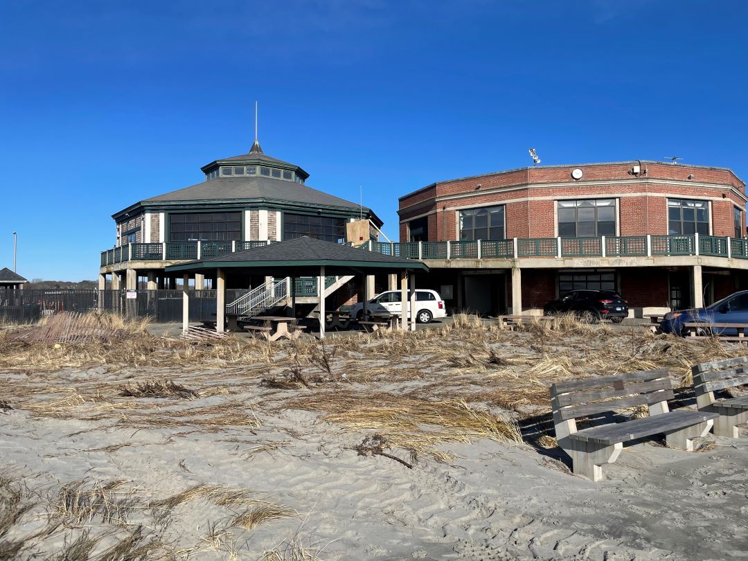
Though Rhode Island hasn’t experienced a really big storm yet this year, she said we are seeing more nuisance flooding, also called high-tide flooding, which happens when we get the type and frequency of precipitation that April brought — it rained every few days, accumulating to nearly 6 inches, which raised the Ocean State’s water table. And when we get a hurricane, she said, the rising sea will make the flood threat dire.
“We are seeing more and more frequent extreme high-tide events,” Freedman said. “We often have a predicted high tide, around a full or new moon, but it’ll actually be a foot or two higher, so low areas like Oakland Beach in Warwick or Market Street in Warren flood.”
Flooding through stormwater infrastructure is another issue, Freedman said. When the sea level is already high, it moves backwards through stormwater systems, so incoming rain has nowhere to go and backs up onto city streets.
“Right now, we’re seeing it several times a year, and we expect to see more,” she said.
The domino effect doesn’t stop there. The state is doing more testing to show how local marine species and waters are impacted by more frequent rainfall. Since so much of Rhode Island’s land is paved or covered by other impervious surfaces, all that water drains directly into Narragansett Bay, dumping contaminants such as fertilizers, petrochemicals, and pet waste into the state’s most important economic resource.
“When I was a kid, we had sprinkles. Now we get torrential downpours that cause flooding on local streets. That has a big impact on water quality,” said Dave Prescott, Save The Bay’s South County coastkeeper. “Bigger precipitation events wash more pollutants into the bay and salt ponds, which compromises the health of marine animals like oysters and flounder, but also our own health, because we swim and kayak all over the place.”
Sign of the times
During his daily rounds of the local watersheds in April, Prescott saw a magnitude of lion’s mane jellyfish, and knew it was oddly early. He also noticed blue crabs common in the Chesapeake Bay and scup from as far as South Carolina that have been invading local waters for years, while more tropical fish such as bigeyes, striped burrfish, and filefish are more recent southern refugees.
Meanwhile, the bounteous lobster Prescott was accustomed to seeing in our usually cold waters are no longer in such plentiful supply. Seeing these species fluctuate is an alarming notion for Prescott, and if we continue with this warming trend, he said, we’ll see big swings of southern species making a permanent home here.
“All taken separately, it’s not much. But these small changes are connected. And that’s the piece that is a little troublesome,” he said. “Some of these storms hitting the Gulf of Mexico are so intense because the water is so warm. And then we have winters that are next to nothing, which leads to ticks and mosquitoes. To suppress the tick population, we need a cold winter with a heavy frost. In addition, they are already spraying Chapman Pond in Westerly for mosquitoes, and last year they sprayed everywhere for mosquitoes. It’s already an issue, and as it warms up, this will get worse.”
You might be wondering what flooding and ticks have to do with a warm winter and early daffodil blooms?
These experts say these issues are dependent on one another. Freedman said a rainy April and sea-level rise are connected. Giuliano said the rise in pesky insects are directly attributed to a warmer winter. Ginis said these changes can be due to a warming of the earth’s atmosphere.
So as global land and ocean surface temperatures continue to rise, the effects are more widespread than we might initially realize — from more jellyfish arriving earlier in the season to global warming-stimulated jet streams bringing warmer winters and more frequent and extreme rain storms that cause local flooding and erosion to skyrocketing tick and mosquito populations.
“Be aware of your surroundings, be aware that things are changing,” Prescott said. “The sun is coming out now but over the past two days we had 1.5 inches of rain. More rainfall means more runoff, means more potentially polluted water. Understand that our climate is changing, and there may be some positives, but there will be some negatives that can impact our lives.”


