6-10 Connector Compromise Includes More Asphalt
December 27, 2016
Share
PROVIDENCE — The Rhode Island Department of Transportation (RIDOT) announced in early December that it arrived at a compromise design with the city to rebuild the 6-10 Connector. The plan maintains the highway in basically its current state, and adds pedestrian and bicycle accommodations to the roads and bridges that surround and cross it.
The most notable improvements are for highway users. First, the missing connection between Route 10 North and Route 6 West is, once again, included in the proposed design. Highway users and business owners from nearby Olneyville Square have universally demanded this connection; currently highway motorists are forced to exit Route 10 North and travel through Olneyville Square to access Route 6 West, causing massive congestion in the commercial district.
The new design improves driver safety by eliminating the cross-over merge at the Harris Avenue on-ramp, letting Harris Avenue traffic access Route 10 South without merging through Route 6 West traffic. Access from Harris Avenue to Route 6 West will also be maintained, according to RIDOT.
The compromise design maintains the current number of driving lanes on routes 6 and 10, unlike the design proposed by the city in September, which suggested narrowing the highway to two lanes per direction. In fact, a new two-lane service road will be added alongside the connector to accommodate the merge-related safety improvement noted above. Infrastructure for a Bus Rapid Transit service is not included in this design, however it could be studied and potentially added in the future, according to RIDOT.
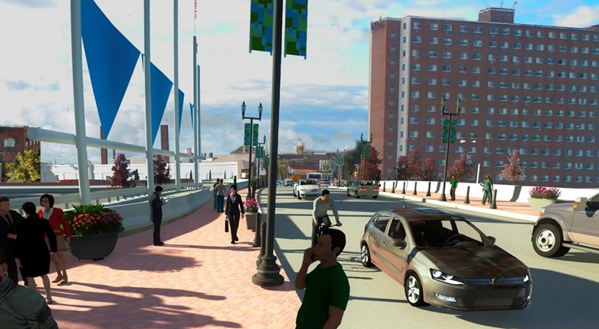
The compromise plan moderately improves pedestrian connections between the Olneyville and West End neighborhoods. The Broadway and Westminster Street bridges over routes 6 and 10 will include improvements for pedestrians and bicyclists. Streetscaping measures and the elimination of about half the length of the Huntington Viaduct will make the journey between neighborhoods more aesthetically pleasant, according to RIDOT.
Currently, the Huntington Viaduct carries Route 10 South traffic over the Westminster Street and Broadway bridges, creating a visual barrier between the neighborhoods. The new plan routes viaduct traffic under the Broadway and Westminster bridges. This strategy eliminates two of the nine existing bridges in the project area, reducing construction and maintenance costs.
While RIDOT’s Dec. 8 press release stated that “Broadway and Westminster Street will be redesigned using ‘complete street’ standards to make neighborhood roadways walkable, transit, and bicycle-friendly,” the department’s project covers only the Broadway and Westminster Street bridges, not the streets leading away from them, according to Charles St. Martin, RIDOT’s chief public affairs officer.
Emily Crowley, director of communications for the city of Providence, said the city is interested in pedestrian and bike improvements to other sections of Westminster Street and Broadway. Through a separate project, she said, the city is analyzing possible improvements for improving the intersection of Broadway and Tobey/Ridge streets.
Also, contradictory to information released by RIDOT, the Westminster Street bridge will not be narrowed to a single lane in each direction, as is depicted in two conceptual drawings included in RIDOT’s slide presentation for the project. The bridge is likely to see reduced usage after the highway ramp connecting Route 10 North and Route 6 West is constructed.
“The number of travel lanes on the Westminster Street overpass will not change from current conditions,” St. Martin told ecoRI News. “It will have four travel lanes — two lanes in each direction. Remember that the renderings are just preliminary concept drawings.”
The existing Tobey Street on-ramp, north of the connector, will be reconstructed to accommodate two-way local traffic and will include a protected bike and pedestrian path. The bridge will still provide access to Route 6 West and Route 10 South for highway users. This is the only new cross-highway connection between Olneyville and West Side neighborhoods in the plan. Neighborhood connectivity was a top priority for the city.
The plan includes 1.4 miles of new bike lanes and paths on the streets and land surrounding the 6-10 Connector. Bike lanes will be added to the Westminster Street and Tobey Street bridges. The Broadway Bridge already has bike lanes. The Washington Secondary Bike Path and the Woonasquatucket River Greenway will be connected by an off-street bike path. This connection is a high priority among bike advocates.
In current renderings, the path crosses the Union Avenue bridge, south of the connector, and then travels north to Westminster Street parallel to Service Road 1 on the east side of Route 10. It then continues north between routes 6 and 10 and Asa Messer Elementary School and Franciscan Park until it reaches the Tobey Street bridge.
The Plainfield Street on-ramp will be eliminated in favor of adding more green space and developable land, according to RIDOT. The on-ramp removal offers the opportunity to add another connection between Silver Lake and Olneyville via Magnolia Street, which is currently divided by the highway.
Magnolia Street isn’t reconnected as part of this project, according to St. Martin. However, it could be in the future if the city’s redevelopment of the area needs that connection and funding were available.
A connection will be made between the Silver Lake and Olneyville neighborhoods via a new street that will be built directly next to the railroad tracks that parallel Route 10.
The removal of the Plainfield Street on-ramp and redesign of the Tobey Street bridge open about 5 acres of developable land, a negligible amount compared to the potential noted in previous design iterations.
At a news conference, RIDOT director Peter Alviti said the project will cost $400 million, matching the money budgeted and available for the project. Design features such as incorporating the Route 10 North to Route 6 West connection into the Westminster Street bridge, and significantly shortening the length of the Huntington Viaduct, freed up money to pursue some of the city’s priorities, he said.
RIDOT hopes to get a request for proposal out to bid within the next few months, and begin construction on the 5-year project by the end of 2017. The design at this point is entirely conceptual, Alviti said, so nothing is set in stone.
RIDOT will meet with city officials to discuss scheduling a joint community workshop to take place after the first of the year, according to St. Martin.
Sweating the details
Advocates once enthusiastic about rebuilding the 6-10 Connector as a multi-modal boulevard have accepted that routes 6 and 10, which disproportionately benefit non-city residents, will continue to divide Providence’s neighborhoods and give children asthma.
“With the inclusion of the bike connection, and the city’s endorsement of this plan, we don’t anticipate continuing to fight for highway removal, but instead to focus on maximizing the implementation of positive details in the plan,” Alex Krogh-Grabbe, director of the Rhode Island Bicycle Coalition, wrote in a recent post on the organization’s website.
He noted that the plan is only conceptual, so pressure needs to be applied on RIDOT to ensure the agency doesn’t renege on bicycle- and pedestrian-friendly design features.
Mayor Jorge Elora, when asked why Providence didn’t push for a more city-oriented design, said he was satisfied with the compromise reached between RIDOT and his planning department.
Given the design constraints imposed by Gov. Gina Raimondo — mostly her insistence that traffic flow not be impacted by the new design, despite the need to dramatically reduce carbon emissions from the transportation sector, the state’s most significant source of emissions — the mayor said the compromise design was the best available option. He also noted that the site’s topography and the presence of the Northeast Regional railroad precluded a pure boulevard from being implemented.
Seth Zeren, spokesman for the Fix the 6-10, which supports a more urban design for the roadway, congratulated officials at the state and city level for reaching a compromise, and called the plan “much improved” compared to the as-is rebuild threatened by the governor earlier in the year. He was especially complimentary of the city’s planning department, noting that its public-engagement effort, research and creative design process were “commendable.”
“We hope that it will serve as a model for improving future DOT public-engagement processes,” he said.
Zeren also noted that Fix the 6-10 will continue in the role of watchdog, “to ensure that the principles that have animated our movement continue to be reflected in the final plan.”
James Kennedy, author of the blog Transport Providence and a leading advocate of tearing the 6-10 Connector down, admitted the boulevard idea is toast, but he is pursuing a new set of demands that fall within the scope of the compromise design.
Via a recent blog post, Kennedy proposed separated bike lanes — not just painted lanes — on each bridge crossing the highway, along with narrow traffic lanes. He also recommended a network of on-street, separated bike lanes in the neighborhoods surrounding the project, instead of the proposed off-street bicycle path that would hug the noisy highway.
Kennedy’s most intriguing idea is to reserve the Tobey Street bridge for pedestrians and bicycles only. He detailed this plan in a piece for RI Future, in which he also recommended eliminating a redundant city street near the bridge in favor of building housing.
Thanks for this thorough analysis. I think the tone of the headline is too negative, but the idea the design is "much improved" is an overstatement considering the above analysis. Seems to me its an opportunity missed, in part because the city backed off, in part because the Fix-thr 6/10 group did little to reach out to develop a broader coalition.
Motorists will also be the target in another $230 million or so project to widen I-95 North thru the very center of the city so that motorists can ore quickly tear thru the city though it would seem to create an even wider gash. Like the 6-10, RIDOT has softened the anti-urban aspect by adding a pedestrian crossing and promising the reduce the footprint of the Dean St interchange. James has written about this too on RIFuture.
Still, the 2 projects, $630 million or so, are mostly part of the drive-everywhere strategy that has done a lot to hurt Providence, and cities generally., not to speak of the global atmosphere. To this one might add the legislature’s intent to (eventually) spend $200 million + to phase out the car tax which would be another gift to motorists, especially to households with many and/or expensive cars.