Power Plant Poses Threat to Area’s Wildlife, Recreational Uses
July 24, 2016
Share
BURRILLVILLE, R.I. — Bill Eccleston grew up here, spending his childhood fishing, hiking, camping and learning to hunt. He still snowshoes here in the winter, and today, just as he did as a kid, he marvels at the area’s collection of towering pines, amazing network of brooks and steams, and fabulous freshwater recreational opportunities.
The longtime Burrillville Middle School English teacher counts himself among the many angered, shocked and saddened that the town, and its special collection of natural resources, could be saddled with another fossil-fuel power plant.
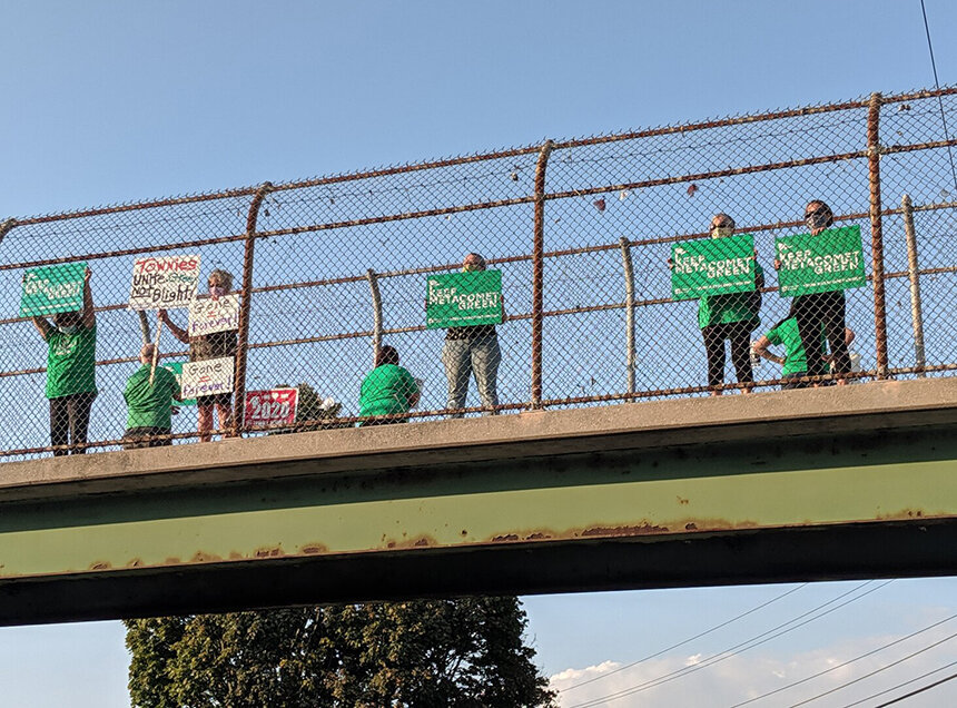
“It’s a big insult,” Eccleston said. “They want to build a friggin’ major industrial facility on the property line of a state forest. This isn’t some NIMBY (not in my backyard) project; it impacts the entire region. It’s in everyone’s backyards.”
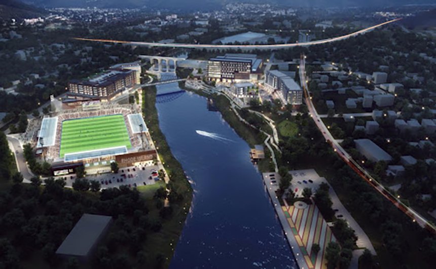
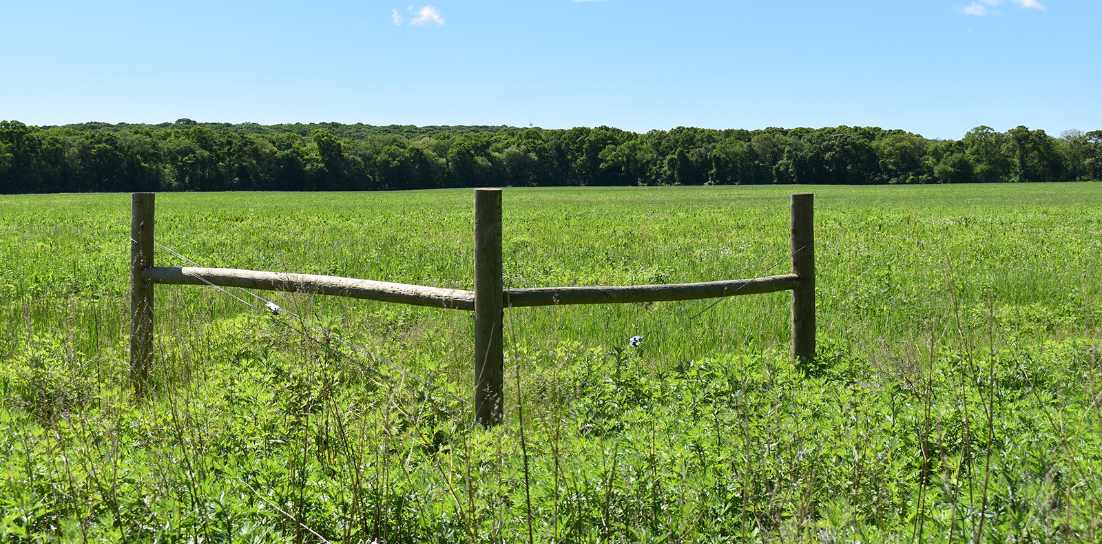
During a recent interview with ecoRI News, Eccleston’s frustration was clearly evident. He’s upset so little attention has been paid to the location of the proposed Clear River Energy Center, on the northeast border of the 4,000-acre George Washington Management Area, which encompasses the Pulaski State Park and Recreational Area.
He’s angry that a natural-gas power plant — plans call for two million-gallon diesel storage tanks to serve as a backup energy source — could be built about 200 feet from Iron Mine Brook, a Clear River tributary.
“They want to put a power plant right in the middle of a wildlife corridor that runs along the spine of the state,” Eccleston said.
He said Burrillville’s modest community is again being abused by class politics, claiming, for example, that a power plant would never be sited on the property line of a state forest or management area in South County.
“Do you think a plant would be built next to Arcadia, the Great Swamp or Burlingame?” said Eccleston, who moved to North Providence about 15 years ago, after 45 years in his hometown. “Do you think a plant would ever be sited next to an Audubon or Nature Conservancy property?”
The nearly 1,000-megawatt fossil fuel power plant proposed for the northwest corner of Rhode Island is sited among some 16,000 acres of protected wilderness in three states: George Washington Management Area, Durfee Hill Management Area and Buck Hill Management Area; Quaddick State Park in Thompson, Conn.; and Douglas State Forest and Mine Brook Wildlife Management Area in Massachusetts.
As one of the most highly valued land-based ecosystems in Rhode Island — it easily could be argued that the state’s northwest corner is second in importance to only the Arcadia area — many project opponents are surprised local and state government and influential environmental nonprofits haven’t done more to fight for the integrity of Burrillville’s rural character.
Just don’t count Eccleston among the opponents who are surprised by the lack of concern. He noted that the Audubon Society and The Nature Conservancy don’t own any of the land around the proposed power plant. He claimed that urban “greens” and the state’s big shots don’t patronize the area.
He said the wildlife and nature areas in and around Burrillville are largely visited by families from Woonsocket and Worcester, Mass. “For many people, this is their Yellowstone Park,” Eccleston said. “The plant isn’t being built in Exeter for a reason.”
He said those with the authority and/or leverage to confront the project haven’t because “they spend all their time in the corridors of power when they should be spending more time in wildlife corridors.”
Eccleston also is offended by claims from the project’s developer. Invenergy Thermal Development LLC has said the location of the proposed site is zoned for power generation, and is one of only a handful of sites in New England close to a major gas pipeline and electrical lines. The Chicago-based company also has said the site is well buffered by woods.
Eccleston argues that the site is miles from land zoned for business or industry, noting that the pipeline and compressor station currently there were built in the 1950s, some 30 years before Burrillville adopted its current zoning ordinances.
He said the area’s “buffering woods” are to buffer wildlife from people, not to shield people from industry.
The town’s Comprehensive Plan says as much, according to Eccleston. He should know, since he was co-chair of the committee that created Burrillville’s original, in 1993. The plan is updated every five years, but he said nothing with respect to land use, wildlife protection and recreation conservation has fundamentally changed since then.
“Much of Burrillville’s planning and future decision-making revolves around the proper use of manmade and natural resources,” according to the plan’s Land Use chapter. “The Town’s natural resources include its forests, surface and groundwater, scenic views, clean air, wildlife, minerals and soils. They present both opportunities and constraints to development, and must be conserved or used with care, so as not to preclude their continued use.
“Historically, development has shown that some areas are naturally more suitable for a particular use than others. If Burrillville is to protect its natural resources and provide a high quality of life for its citizens, the capability of its natural resources to accommodate development must be respected.”
The proposed Clear River Energy Center isn’t the first fossil fuel plant to be sited in Rhode Island’s northwest corner. The first, Ocean State Power (OSP), began operating in 1990 and required approval from the Federal Energy Regulatory Commission (FERC). For reasons unclear, the Clear River Energy Center doesn’t require FERC approval.
During the siting process for OSP, 82 locations throughout southern New England were reviewed. Two of the last four or five sites being considered, Sherman Farm Road and Buck Hill Road, were both deemed inappropriate by the U.S. Fish & Wildlife Service.
“Based on our review of the DEIS (Draft Environmental Impact Statement) and other relevant information, we recommend that the Buck Hill Road and Sherman Farm Road sites be deleted from further consideration as potential locations for the proposed combined-cycle power plant,” Gordon Beckett, New England supervisor for the U.S. Fish & Wildlife Service, wrote in a letter attached to the July 1988 Final Environmental Impact Statement Volume II. “We believe the proposed project is inconsistent and incompatible with the existing land use on and adjacent to these Wildlife Management Areas.”
Beckett also wrote that, “We believe siting these facilities close to wildlife management areas, parks and similar public facilities should be considered fatal flaws and, therefore, the Buck Hill Road and Sherman Farm Road sites should be eliminated from further consideration.”
The federal agency’s concerns were ignored, and the 560-megawatt OSP facility was built on Sherman Farm Road — the preferred site of the developer, the Tennessee Gas Pipeline Co.
Richard Enser, the former coordinator of the Rhode Island Department of Environmental Management’s since-defunded Natural Heritage Program, is worried that the same concerns also will be ignored this time.
He recently told ecoRI News that there is too little data available to make an informed decision about the power plant’s impact on the surrounding ecosystem.
“We need better studies and more surveys,” the South Kingstown resident said. “It would be a real mistake, as consultants for Invenergy have suggested, to buy acres somewhere else in the state to serve as a mitigation. Burrillville has the largest piece of forest in the state and they want to stick a power plant in the middle of it.
“Buying up land miles away somewhere else in the state doesn’t mitigate the impact in Burrillville, but it does make everyone feel better.”
Editor’s note: To read the full Environmental Impact Statement for the OSP project, click here.
How can I get a sign for my three front yards here in Providence. The discussion should be about refurbishing the power plant in downtown Providence – not destroying a pristine ecology.
Contact the Keep Burrillville Beautiful Facebook page – they can direct you to signage. Thank you for your concern and willingness to raise awareness!
Just want to make one correction regarding US Fish & Wildlife Service’s opinion of both the "Sherman Farm Road" and "Buck Hill Road" sites during the Ocean State Power Environmental Impact Statement process in the ’80’s.
First, to clarify a point, the "Buck Hill Road site" during the OSP process was a site intended to be sub-divided from the nearly 800 acre holdings of the Algonquin Gas Transmission Company, comprised of nine separate but contiguous parcels. Invenergy, if approved, will execute a sales agreement with Algonquin that will site their plant on a sub-division of the same contiguous holdings, but some 3,000 feet southeast of the site that OSP identified. OSP’s site was called "Buck Hill Road" because it would egress onto Buck Hill Road while the Invenergy site would egress onto Wallum Lake Road. Ecologically speaking, a distinction without a difference. The Invenergy site itself would border the George Washington Forest.
The "Buck Hill Road site," however, was not among the "final sites" considered along with Sherman Farm Road where the plant was eventually permitted. The "Buck Hill Road site" was eliminated in the semi-final round of consideration. The finalists were Sherman Farm Road and the so-called "Bryant College" site in Rhode Island, and the the "Ironstone" site in Uxbridge, MA.
Significant also was that RI DEM made an ecological distinction between the the Buck Hill and Sherman Farm Road sites. They found the Buck Hill Road site significantly less appropriate as a power plant site because of the greater ecological value of its surrounding forest, especially in terms of rare or endangered flora and fauna, while the surroundings of Sherman Farm Road, six miles to the east, had less ecological value. The testimony is by DEM biologist, Chris Raithel, and is found on page W-132 of Volume II of the OSP EIS files. A look at DEM’s interactive "Conservation Opportunities" map in its 2015 Wildlife Action Plan graphically illustrates the difference in value between the two sites.
How can I help stop this????