To Meet Rising Waters Homeowners Must Rise Up or Get Out
October 24, 2015
Share
Since tropical storm Irene in 2011, more than $2 million has been spent to elevate 22 coastal homes that repeatedly flood, earning them the term “repetitive loss” by the Federal Emergency Management Agency (FEMA).
A home that was deemed a severe repetitive loss on Warwick Cove in Warwick was the latest to receive a FEMA grant. City officials wouldn’t reveal the location of the home, only saying that the property was awarded 100 percent of the $125,700 project cost.
“By elevating this property, the risk of future flooding will be significantly reduced. It’s always a great thing when a residential property can be saved from future damage,” Warwick Mayor Scott Avedesian said in a prepared statement.
The state’s coastal planning agency agrees with the rebuild-and-go-higher concept. Coastal Resources Management Council (CRMC) executive director Grover Fugate said elevating helps reduce flood insurance costs for homeowners, gives a boost to the construction industry and keeps higher-priced homes on the tax rolls.
A major issue, Fugate said, is elevating low-lying buildings so that floodwaters can flow underneath structures instead of washing buildings out to sea.
“It’s our desire to see Rhode Island become hardened to these storms,” he said.
That doesn’t mean Fugate is endorsing building protective walls around houses. Rather, he wants the homes where owners don’t want to move to withstand heavy winds and other storm elements and thereby save property owners and communities repair and clean-up costs. Raising buildings, he said, also helps property owners adjust to the restructuring of the federal flood insurance program, which, in an effort to eliminate subsidies, has increased some flood insurance premiums to as much as $60,000. Homeowners that raise the first floor above the flood elevation pay less for their insurance.
“If we can find a way where we can subsidize or maybe amortize that improvement over the life of the structure so that it makes these improvements more affordable, it will reduce our risks, it will reduce government payouts in terms of the damage that will be done to those areas, it will keep people in their homes,” Fugate said during a recent meeting of a House commission studying the economic impacts of climate change.
Cranston has followed a different path. After major flooding in 2005 and 2010 and other flood events along the Pawtuxet River and its tributaries, the city has bought 15 homes in floodplains, torn them down and kept the lots undeveloped.
“We let nature take it’s course,” said Peter Lapolla, the city’s planning director.
All of the homeowners agreed to sell their homes for a price between $100,000 and $200,000. The funding came from FEMA grants and the Community Development Block Grant program run by the U.S. Department of Housing and Urban Development.
Lapolla said the cost of cleanup after floods exceeds the tax revenue from each home, especially when other city services are added into the list of expenses.
He said it was wrong to ever allow those houses to be built in a floodplain. “The most ideal solution is to make (the homes) go away,” Lapolla said.
Westerly has done the most of the structural elevation in Rhode Island, with 15 homes, many of them vacation properties, either elevated or approved for the work. Most of those requests came after Irene struck four years ago. Property owners received about $111,000 per home and are responsible for 25 percent of the project cost. Applications are pending with FEMA for three more structures.
As part of the regular update to its comprehensive plan, the town will consider other options for repetitive-loss properties such as relocating and removing structures.
“We encourage residents to mitigate the best they can because we don’t know what the next storm will bring,” said Amy Grybowski, Westerly’s planning director of code enforcement and grant administration.
Grybowski admires Cranston’s buyout program but she conceded that the cost to purchase threatened coastal homes in Westerly would be upwards of $700,000 per property.
“(FEMA) wouldn’t pass that much funding,” she said.
Meanwhile, local flooding and erosion are only expected to worsen. According to Fugate, Rhode Island could experience a foot of sea-level rise within the next 20 years and up to 7 feet by 2100. He noted that a few years ago the scientific consensus was 3-5 feet of sea-level rise by the end of the century.
“Seven feet is a game-changer for us,” Fugate said at the Oct. 15 House commission meeting. “The science that comes out every day — those estimates tend to go up. They don’t go down.”
Fugate noted that South Kingston Town Beach has receded nearly 400 feet since 1950. Marshland across Narragansett Bay is being lost at a much faster rate, he said.
“It’s basically unprecedented in geological history the rate of loss we are seeing right now,” Fugate said.
CMRC is overseeing the development of a coastal policy guide to help communities and building owners adapt to rising seas. The Shoreline Special Area Management Plan (Beach SAMP) will examine relocating and retreating for repetitive-loss properties. Fugate noted that some coastal homes are already too close to the water, in an area called the surf zone, and beyond the point of elevating.
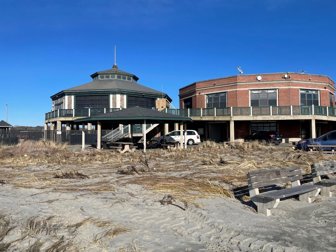
Where there is room, some homes in South Kingstown, as well as the pavilion at the public beach, have been moved inland. However, many other coastal structures don’t have the real estate to move. So for now, the focus is on elevating structures, Fugate said.
“It will preserve the property values and hence the tax base for those communities and we will be putting the building industry back into business in this state,” he said.
Rebuilding and elevating isn’t a local concept. A recent White House executive order requires all federally funded projects to be elevated to meet current projections for sea-level rise and flooding.
Here is a look at how a portion of FEMA funds have been spent after recent storms:
Tropical Storm Irene (Aug. 27-29, 2011)
• $891,132 to elevate 8 residences in Westerly
• $9.6 million was spent on debris removal
Superstorm Sandy (Oct. 26-31, 2012)
• $737,006 to buy 5 residences for demolition in Cranston
• $498,788 to elevate 6 homes in Westerly
• $5.6 million was spent on debris removal
Winter Storm Nemo (Feb. 8-10, 2013)
• $129,811 to buy 1 residence for demolition in Cranston
• $644,871 to elevate 6 residences in Barrington
• $7 million for emergency protective measures


If you look at the results of CRMC’s "coastal protection efforts" are virtually non-existent in Westerly’s Misquamicut Beach area. You see luxury homes built in salt ponds. This is also happening in Narragansett RI. There a luxury home was built in the Money salt pond wetlands, despite Save the Bays’ protest. (Google 1444 Ocean Rd, Narragansett to see the articles, and maps that prove that CRMC "permits" salt pond wetlands to be filled when the wealthy wants an
"ocean view". In other words, CRMC, like RI DEM, is nothing more than a "front" for developers. So as we are distracted the "trending" climate change threat, CRMC and RI DEM are sanctioned the development of our wetlands.
For more proof see DEM’s development plans for the Pawcatuck valley watershed.
http://www.dem.ri.gov/programs/bpoladm/suswshed/desmanul/chapter3_forested.html
is it not public domain 15 feet above average mean high tide levels
It never ceases to amaze me on how much you can buy with other people’s money.
Our society has a lot more important needs than saving homes that perhaps should not have been built where they were. But these people have been able to enjoy these beautiful spots and now it is time to face the music. We the taxpayers do not need to subsidize a solution to their problem. We need to spend our limited resources to plan for the protection and or retreat of public infrastructure. They and their insurance co. also subsidized by taxpayers, need to plan on a removal plan so their homes will not become part of the very expensive clean up process after the next storm. I grew up on the Barrington river and enjoyed it in a boat, living safely back from its edge. I now live on Martha’s Vineyard and believe me we are looking to the future with the realization that a plan for retreat will be costly and complicated but getting the priorities right is the real challenge. Richard Toole, Oak Bluffs, Ma.